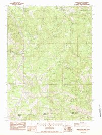
1983 Map of Siskiyou Pass
USGS Topo · Published 1983About this map
Siskiyou Pass serves as the central focal point for this 1983 study of the high-elevation boundary between Oregon and California. The landscape is defined by the technical challenges of crossing the Siskiyou Mountains, visible through the complex engineering of the Steinman railroad loop and multiple tunnels. The transition from early transit to modern infrastructure is evident in the presence of the Old Road alongside the Pacific Highway, while the Pacific Scenic Highway winds through the southern terrain.
Find a feature on this map
50 named features on this map. Tap any name to fly to it.
Don’t see what you’re looking for? This feature index may not catch every label — zoom into the map to look around manually.
Map Details
Editions of this 1983 Siskiyou Pass Map
3 editions found
Other maps of this area

1886 · Shasta
USGS Topo · 1:250,000

1891 · Ashland
USGS Topo · 1:250,000

1893 · Ashland
USGS Topo · 1:250,000

1894 · Shasta
USGS Topo · 1:250,000

1897 · Ashland
USGS Topo · 1:250,000

1922 · Shasta Valley Sheet No 15
USGS Topo · 1:24,000

1932 · Yreka
USGS Topo · 1:96,000

1934 · Macdoel
USGS Topo · 1:96,000

1938 · Medford
USGS Topo · 1:125,000

1939 · Yreka
USGS Topo · 1:125,000