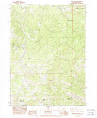
1983 Map of Siskiyou Pass
USGS Topo · Published 1988About this map
The Siskiyou Mountains define this high-altitude landscape along the border of Oregon and California. This area is dominated by the critical transport corridor over Siskiyou Pass, where the railway and power infrastructure navigate the steep climb toward Siskiyou Summit. Historical human activity is marked by sites like the Wooden Schoolhouse in the north and the Dollarhide (Site) near the western slopes. The map traces the engineering required for this passage, including the Buck Rock Tunnel and the Green Springs Powerplant near Emigrant Creek. Recreational and natural landmarks are prominent, from the Pacific Crest National Scenic Trail winding through the peaks to named water sources like Buckhorn Springs and McCallister Spring. The southern portion transitions into the Klamath National Forest, emphasizing the area's role as a protected wilderness and a vital mountain crossing.
Find a feature on this map
36 named features on this map. Tap any name to fly to it.
Don’t see what you’re looking for? This feature index may not catch every label — zoom into the map to look around manually.
Map Details
Editions of this 1983 Siskiyou Pass Map
3 editions found
Other maps of this area

1886 · Shasta
USGS Topo · 1:250,000

1891 · Ashland
USGS Topo · 1:250,000

1893 · Ashland
USGS Topo · 1:250,000

1894 · Shasta
USGS Topo · 1:250,000

1897 · Ashland
USGS Topo · 1:250,000

1922 · Shasta Valley Sheet No 15
USGS Topo · 1:24,000

1932 · Yreka
USGS Topo · 1:96,000

1934 · Macdoel
USGS Topo · 1:96,000

1938 · Medford
USGS Topo · 1:125,000

1939 · Yreka
USGS Topo · 1:125,000