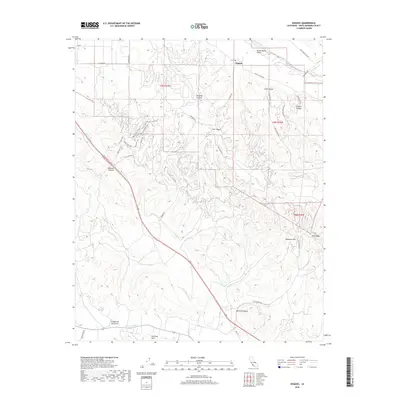
2018 Map of Sisquoc
USGS Topo · Published 2018About this map
Sisquoc stands at the northern edge of this landscape, situated where the Sisquoc River meets the fertile floor of the Santa Maria Valley. The terrain to the south and east transitions into a complex system of ridges and canyons, most notably the Solomon Hills and Purisima Hills. This area is defined by its network of canyons, including Cat Canyon, Bradley Canyon, and Solomon Canyon, which historically served as vital corridors through the upland terrain. A significant system of recreational paths is concentrated in the western hills, featuring the Dinosaur Loop Trail, Manzanita Trail, and Valley View Trail. These paths trace the contours of the high ground, providing a unique look at the drainage patterns of Orcutt Cr and San Antonio Cr. The map details a landscape where industrial access roads like Foxen Canyon RD and Cat Canyon RD weave between agricultural valleys and the rugged interior ridges of Gato Ridge.
Find a feature on this map
42 named features on this map. Tap any name to fly to it.
Don’t see what you’re looking for? This feature index may not catch every label — zoom into the map to look around manually.
Map Details
Editions of this 2018 Sisquoc Map
This is the sole edition of this map. No revisions or reprints were ever made.
Other maps of this area

1905 · Lompoc
USGS Topo · 1:125,000

1942 · Lompoc
USGS Topo · 1:125,000

1942 · Lompoc
USGS Topo · 1:62,500

1942 · Santa Maria
USGS Topo · 1:62,500

1942 · Tepusquet Peak
USGS Topo · 1:62,500

1942 · Los Olivos
USGS Topo · 1:62,500

1943 · Los Olivos
USGS Topo · 1:62,500

1943 · Tepusquet Peak
USGS Topo · 1:62,500

1943 · Lompoc
USGS Topo · 1:125,000

1947 · Lompoc
USGS Topo · 1:24,000