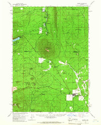
1959 Map of Sisters
USGS Topo · Published 1966About this map
The mountain town of Sisters serves as the focal point for this 1950s-era survey of central Oregon. The landscape is defined by its transition from high desert pine forests to the volcanic peaks of the Cascade Range, centered around the prominent Black Butte. Transportation history is layered here, with the modern Santiam Highway and McKenzie Highway converging near town, while the historic Old Santiam Wagon Road traces a more primitive route across the terrain.
Find a feature on this map
76 named features on this map. Tap any name to fly to it.
Don’t see what you’re looking for? This feature index may not catch every label — zoom into the map to look around manually.
Map Details
Editions of this 1959 Sisters Map
2 editions found

Other maps of this area

1926 · Bend
USGS Topo · 1:125,000

1927 · Mt. Jefferson
USGS Topo · 1:125,000

1928 · Madras
USGS Topo · 1:125,000

1929 · Bend
USGS Topo · 1:125,000

1929 · Three Sisters
USGS Topo · 1:125,000

1930 · Mt. Jefferson
USGS Topo · 1:125,000

1931 · Madras
USGS Topo · 1:125,000

1932 · Three Sisters
USGS Topo · 1:125,000

1955 · Bend
USGS Topo · 1:250,000

1957 · Bend
USGS Topo · 1:250,000