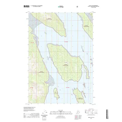
2021 Map of Sitka D-1 NW
USGS Topo · Published 2021About this map
Swan Island dominates the central waters of this Alaskan coastal survey, situated within the expansive reach of the Tongass National Forest. The landscape is defined by its maritime geography, where isolated landforms like Windfall Island and the prominent southern tip of Late Point punctuate the surrounding inlets. On the mainland to the west, the drainage of Pack Cr flows through the dense timber, accompanied by the Pack Creek Trl which provides a rare inland path through the wilderness. This map reveals a terrain where the boundary between temperate rainforest and the Pacific is absolute, showing the sparse but vital infrastructure of the United States Forest Service in the region.
Find a feature on this map
11 named features on this map. Tap any name to fly to it.
Don’t see what you’re looking for? This feature index may not catch every label — zoom into the map to look around manually.
Map Details
Editions of this 2021 Sitka D-1 NW Map
This is the sole edition of this map. No revisions or reprints were ever made.
Other maps of this area

1948 · Sitka D-1
USGS Topo · 1:63,360

1948 · Sitka D-2
USGS Topo · 1:63,360

1951 · Juneau
USGS Topo · 1:250,000

1951 · Juneau A-2
USGS Topo · 1:63,360

1951 · Sitka
USGS Topo · 1:250,000

1951 · Juneau A-1
USGS Topo · 1:63,360

1951 · Sitka D-1
USGS Topo · 1:63,360

1951 · Sitka D-2
USGS Topo · 1:63,360

1952 · Sitka
USGS Topo · 1:250,000

1954 · Juneau A-1
USGS Topo · 1:63,360