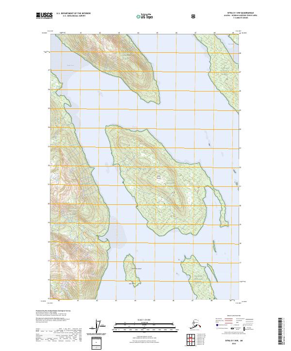
2024 Map of Sitka D-1 NW
USGS Topo · Published 2024About this map
Admiralty Island National Monument and the surrounding coastal waters of the Alexander Archipelago dominate this 2024 survey. The map details the intricate shoreline of the Kootznoowoo Wilderness, where the landscape is defined by the tidal fluctuations of Swan Cove and Fool Inlet. A single established pathway, the Pack Creek Trl, follows the course of Pack Creek inland, providing rare human access to this dense coastal forest. Significant landforms like Swan Island and Windfall Island sit offshore, marking the transition from the mountainous interior of Tongass National Forest to the sea. The inclusion of Late Point and various maritime boundaries highlights the ongoing federal management and preservation of this isolated ecosystem.
Find a feature on this map
14 named features on this map. Tap any name to fly to it.
Don’t see what you’re looking for? This feature index may not catch every label — zoom into the map to look around manually.
Map Details
Editions of this 2024 Sitka D-1 NW Map
This is the sole edition of this map. No revisions or reprints were ever made.
Other maps of this area

1948 · Sitka D-1
USGS Topo · 1:63,360

1948 · Sitka D-2
USGS Topo · 1:63,360

1951 · Juneau
USGS Topo · 1:250,000

1951 · Juneau A-2
USGS Topo · 1:63,360

1951 · Sitka
USGS Topo · 1:250,000

1951 · Juneau A-1
USGS Topo · 1:63,360

1951 · Sitka D-1
USGS Topo · 1:63,360

1951 · Sitka D-2
USGS Topo · 1:63,360

1952 · Sitka
USGS Topo · 1:250,000

1954 · Juneau A-1
USGS Topo · 1:63,360