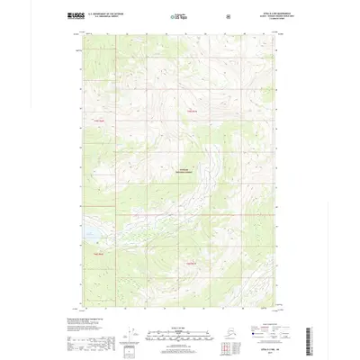
2017 Map of Sitka D-2 NW
USGS Topo · Published 2017About this map
Tongass National Forest dominates this coastal Alaskan landscape, where the terrain is defined by steep elevation changes and intricate drainages. The Lake Kathleen basin serves as a primary hydrological feature in the southwest, fed by unnamed tributaries descending from the high ridges. Further north, the flow of Wheeler Cr cuts through the forest, illustrating the natural water systems that characterize this part of the Alexander Archipelago. The 2017 survey reflects the remote and preserved character of the region, emphasizing the natural topography and the boundaries of the Tongass National Forest without the presence of modern road infrastructure or permanent settlements.
Find a feature on this map
7 named features on this map. Tap any name to fly to it.
Don’t see what you’re looking for? This feature index may not catch every label — zoom into the map to look around manually.
Map Details
Editions of this 2017 Sitka D-2 NW Map
This is the sole edition of this map. No revisions or reprints were ever made.
Other maps of this area

1948 · Juneau A-3
USGS Topo · 1:63,360

1948 · Sitka D-3
USGS Topo · 1:63,360

1948 · Sitka D-2
USGS Topo · 1:63,360

1950 · Juneau A-3
USGS Topo · 1:63,360

1951 · Juneau
USGS Topo · 1:250,000

1951 · Juneau A-2
USGS Topo · 1:63,360

1951 · Sitka
USGS Topo · 1:250,000

1951 · Sitka D-3
USGS Topo · 1:63,360

1951 · Sitka D-2
USGS Topo · 1:63,360

1952 · Sitka
USGS Topo · 1:250,000