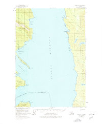
1951 Map of Sitka D-3
USGS Topo · Published 1977About this map
Chatham Strait divides this coastal landscape during the mid-twentieth century, separating the eastern shores of Chichagof Island from the rugged coastline of Admiralty Island. The map documents a maritime-focused environment where inland water bodies like Lake Kathleen and Lake Florence sit just miles from the salt water. Evidence of early industrial activity appears at Gypsum (Aband) near Iyoukeen Cove, marking the site of a former mining operation that once utilized the deep-water access of the Iyoukeen Peninsula. Numerous inlets and points, such as Freshwater Bay and Tenakee Inlet, define the complex shoreline. The transition from active resource extraction to the established boundaries of the City and Borough of Sitka reflects the shifting administrative and economic character of Southeast Alaska during this era.
Find a feature on this map
31 named features on this map. Tap any name to fly to it.
Don’t see what you’re looking for? This feature index may not catch every label — zoom into the map to look around manually.
Map Details
Editions of this 1951 Sitka D-3 Map
3 editions found

Other maps of this area

1948 · Juneau A-3
USGS Topo · 1:63,360

1948 · Juneau A-4
USGS Topo · 1:63,360

1948 · Sitka C-2
USGS Topo · 1:63,360

1948 · Sitka C-3
USGS Topo · 1:63,360

1948 · Sitka D-3
USGS Topo · 1:63,360

1948 · Sitka D-2
USGS Topo · 1:63,360

1948 · Sitka D-4
USGS Topo · 1:63,360

1950 · Juneau A-3
USGS Topo · 1:63,360

1951 · Juneau
USGS Topo · 1:250,000

1951 · Juneau A-2
USGS Topo · 1:63,360