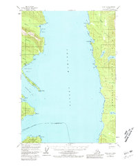
1951 Map of Sitka D-3
USGS Topo · Published 1981About this map
Chichagof Island and Admiralty Island face one another across the wide expanse of Chatham Strait in this early 1950s survey. The map details a landscape of rugged maritime industry and wilderness, most notably at the site of Gypsum (Abandoned) on the western shore. This location, situated near the tidal flats of Gypsum Creek, represents the remains of early 20th-century mining activity that once drove the local economy before the site was left to the elements.
Find a feature on this map
33 named features on this map. Tap any name to fly to it.
Don’t see what you’re looking for? This feature index may not catch every label — zoom into the map to look around manually.
Map Details
Editions of this 1951 Sitka D-3 Map
3 editions found

Other maps of this area

1948 · Juneau A-3
USGS Topo · 1:63,360

1948 · Juneau A-4
USGS Topo · 1:63,360

1948 · Sitka C-2
USGS Topo · 1:63,360

1948 · Sitka C-3
USGS Topo · 1:63,360

1948 · Sitka D-3
USGS Topo · 1:63,360

1948 · Sitka D-2
USGS Topo · 1:63,360

1948 · Sitka D-4
USGS Topo · 1:63,360

1950 · Juneau A-3
USGS Topo · 1:63,360

1951 · Juneau
USGS Topo · 1:250,000

1951 · Juneau A-2
USGS Topo · 1:63,360