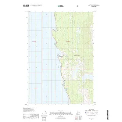
2021 Map of Sitka D-3 NE
USGS Topo · Published 2021About this map
The coastal interface of Tongass National Forest along the Chatham Strait shoreline is the primary focus of this 2021 study. The landscape is defined by its maritime entry points, most notably the indentation of Cube Cove, which sits south of Square Cove and the prominent Cube Point. These coastal features provided essential shelter and access for early 21st-century nautical and forest service operations. Inland, the topography rises sharply from the saltwater, punctuated by drainage systems like Wheeler Cr and secluded freshwater bodies. Higher elevations to the east contain Peanut Lake and the northern portion of Lake Kathleen, showcasing the hydrological transition from mountain runoff to the sea. This survey by the U.S. Geological Survey documents a wilderness area where geographic names such as Point Hepburn serve as critical markers for navigation along this remote Alaskan coastline.
Find a feature on this map
12 named features on this map. Tap any name to fly to it.
Don’t see what you’re looking for? This feature index may not catch every label — zoom into the map to look around manually.
Map Details
Editions of this 2021 Sitka D-3 NE Map
This is the sole edition of this map. No revisions or reprints were ever made.
Other maps of this area

1948 · Juneau A-3
USGS Topo · 1:63,360

1948 · Sitka D-3
USGS Topo · 1:63,360

1948 · Sitka D-2
USGS Topo · 1:63,360

1950 · Juneau A-3
USGS Topo · 1:63,360

1951 · Juneau
USGS Topo · 1:250,000

1951 · Juneau A-2
USGS Topo · 1:63,360

1951 · Sitka
USGS Topo · 1:250,000

1951 · Sitka D-3
USGS Topo · 1:63,360

1951 · Sitka D-2
USGS Topo · 1:63,360

1952 · Sitka
USGS Topo · 1:250,000