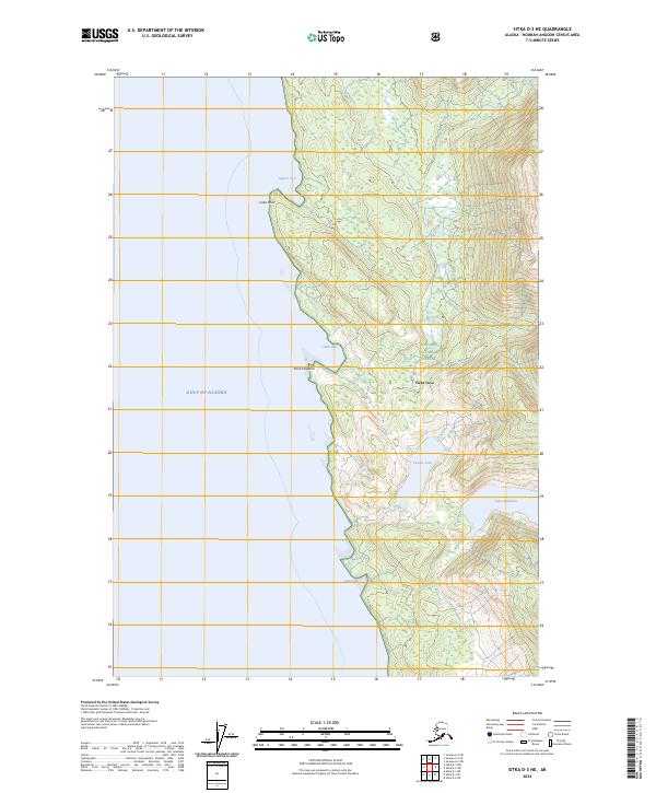
2024 Map of Sitka D-3 NE
USGS Topo · Published 2024About this map
Admiralty Island National Monument and the Kootznoowoo Wilderness encompass the majority of this coastal landscape along the Gulf of Alaska. The topography is defined by the sharp transition from the shoreline at Cube Cove and Point Hepburn to the high inland terrain of the Tongass National Forest. Fresh water is prominently represented by inland features like Lake Kathleen and Pearat Lake, while the coastline is carved into distinct maritime landmarks such as Square Cove and Jims Cove. The mapping reflects a region dominated by protected wilderness and national forest designations, where human infrastructure is largely absent in favor of natural drainage systems like Wheeler Creek. This detailed 2024 survey captures the precise boundary between marine environments and the dense wilderness of the Alaskan Panhandle.
Find a feature on this map
17 named features on this map. Tap any name to fly to it.
Don’t see what you’re looking for? This feature index may not catch every label — zoom into the map to look around manually.
Map Details
Editions of this 2024 Sitka D-3 NE Map
This is the sole edition of this map. No revisions or reprints were ever made.
Other maps of this area

1948 · Juneau A-3
USGS Topo · 1:63,360

1948 · Sitka D-3
USGS Topo · 1:63,360

1948 · Sitka D-2
USGS Topo · 1:63,360

1950 · Juneau A-3
USGS Topo · 1:63,360

1951 · Juneau
USGS Topo · 1:250,000

1951 · Juneau A-2
USGS Topo · 1:63,360

1951 · Sitka
USGS Topo · 1:250,000

1951 · Sitka D-3
USGS Topo · 1:63,360

1951 · Sitka D-2
USGS Topo · 1:63,360

1952 · Sitka
USGS Topo · 1:250,000