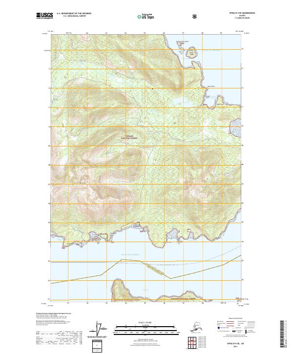
2021 Map of Sitka D-4 SE
USGS Topo · Published 2021About this map
Tongass National Forest defines the wilderness character of this coastal Alaskan landscape, where the Chichagof Island interior meets the Gulf of Alaska. The drainage of Pavlof Lake and the Pavlof River serves as a central hydrological feature, flowing toward the protected waters of Pavlof Harbor. Along the southern coastline, a lone Cannery at Cannery Point points to the region's enduring maritime industrial ties. The terrain is marked by significant elevations like Mt Parish and distinctive geological formations including a Hanging Valley and Pavlof Ridge. Navigational landmarks such as Pinnacle Rock, Cedar Island, and Little Cedar Island dot the intricate shoreline, which is deeply indented by Waschussetts Cove and Coffee Cove. Rare overland access is indicated by the Inlet Road and the No 2 Creek Trl, providing routes through the dense forest and across numerous waterways like Harley Cr and No 1 Creek.
Find a feature on this map
38 named features on this map. Tap any name to fly to it.
Don’t see what you’re looking for? This feature index may not catch every label — zoom into the map to look around manually.
Map Details
Editions of this 2021 Sitka D-4 SE Map
This is the sole edition of this map. No revisions or reprints were ever made.
Other maps of this area

1948 · Sitka C-3
USGS Topo · 1:63,360

1948 · Sitka D-3
USGS Topo · 1:63,360

1948 · Sitka D-4
USGS Topo · 1:63,360

1951 · Sitka C-4
USGS Topo · 1:63,360

1951 · Sitka
USGS Topo · 1:250,000

1951 · Sitka D-3
USGS Topo · 1:63,360

1951 · Sitka C-3
USGS Topo · 1:63,360

1952 · Sitka
USGS Topo · 1:250,000

1955 · Sitka D-4
USGS Topo · 1:63,360

1964 · Sitka
USGS Topo · 1:250,000