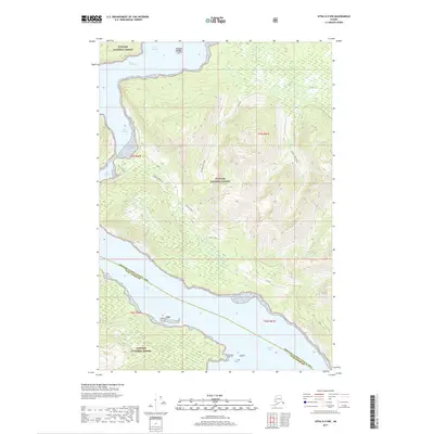
2017 Map of Sitka D-5 NW
USGS Topo · Published 2017About this map
Tongass National Forest dominates this coastal landscape in the Alexander Archipelago, showing a wilderness defined by its intricate shoreline and deep glacial inlets. The map illustrates the narrow waterways connecting Port Frederick and Tenakee Inlet, where The Narrows provides a passage through the dense forest terrain. A network of forest service routes, including 15 Mile and several numbered spurs, penetrate the wooded interior, likely serving the timber interests or recreation within the federal land. Coastal features such as Salt Lake Bay, Salt Chuck, and Midway Island highlight the importance of maritime access in this region. The boundary between the Hoonah-Angoon Census Area and Sitka Borough bisects the southern waters, marking the administrative divisions of this sparsely settled coastal environment.
Find a feature on this map
19 named features on this map. Tap any name to fly to it.
Don’t see what you’re looking for? This feature index may not catch every label — zoom into the map to look around manually.
Map Details
Editions of this 2017 Sitka D-5 NW Map
This is the sole edition of this map. No revisions or reprints were ever made.
Other maps of this area

1948 · Sitka D-5
USGS Topo · 1:63,360

1948 · Sitka D-6
USGS Topo · 1:63,360

1951 · Juneau
USGS Topo · 1:250,000

1951 · Juneau A-6
USGS Topo · 1:63,360

1951 · Juneau A-5
USGS Topo · 1:63,360

1951 · Sitka
USGS Topo · 1:250,000

1951 · Sitka D-6
USGS Topo · 1:63,360

1951 · Sitka D-5
USGS Topo · 1:63,360

1952 · Sitka
USGS Topo · 1:250,000

1962 · Juneau
USGS Topo · 1:250,000