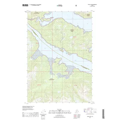
2017 Map of Sitka D-6 NE
USGS Topo · Published 2017About this map
Tenakee Inlet and Port Frederick define this maritime environment within the Tongass National Forest, illustrating the intricate coastal geography of Southeast Alaska. The map centers on the peninsula separating these two major waterways, where the boundary between the Hoonah-Angoon Census Area and Sitka Borough bisects the terrain. Of particular interest to researchers are the local forest routes and spurs that navigate the interior heights, such as Lake 132 and the curiously named Lake 132 Don't Want Spur. The landscape is dominated by steep coastal drainages and inland water bodies like Lake View, while the eastern shore is marked by the sheltered waters of Salt Lake Bay and the vicinity of N Side Salt Lake. Small landmarks like Bell Island provide further geographic context for navigating this roadless, forested expanse.
Find a feature on this map
16 named features on this map. Tap any name to fly to it.
Don’t see what you’re looking for? This feature index may not catch every label — zoom into the map to look around manually.
Map Details
Editions of this 2017 Sitka D-6 NE Map
This is the sole edition of this map. No revisions or reprints were ever made.
Other maps of this area

1948 · Sitka D-5
USGS Topo · 1:63,360

1948 · Sitka D-6
USGS Topo · 1:63,360

1951 · Juneau
USGS Topo · 1:250,000

1951 · Juneau A-6
USGS Topo · 1:63,360

1951 · Juneau A-5
USGS Topo · 1:63,360

1951 · Sitka
USGS Topo · 1:250,000

1951 · Sitka D-6
USGS Topo · 1:63,360

1951 · Sitka D-5
USGS Topo · 1:63,360

1952 · Sitka
USGS Topo · 1:250,000

1962 · Juneau
USGS Topo · 1:250,000