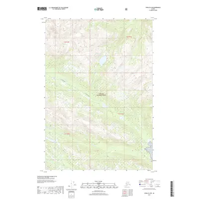
2017 Map of Sitka D-6 SW
USGS Topo · Published 2017About this map
Lisianski River and the surrounding drainage basins of the Tongass National Forest dominate this 2017 survey of the Southeast Alaska wilderness. The map documents a landscape defined by extreme relief and glacial topography, where the Steelhead River and Granite Cr cut through steep mountain corridors. Unlike many maps of this era that show human development, this sheet illustrates a nearly untouched coastal rainforest environment within the Unorganized Borough. The absence of roads or settlements emphasizes the remote nature of these watersheds, which are primary features for understanding the hydrology and land management boundaries of the Alexander Archipelago. Researchers can trace the fine-grained contour intervals that delineate the complex ridges and valley floors that characterize this protected forest land.
Find a feature on this map
8 named features on this map. Tap any name to fly to it.
Don’t see what you’re looking for? This feature index may not catch every label — zoom into the map to look around manually.
Map Details
Editions of this 2017 Sitka D-6 SW Map
This is the sole edition of this map. No revisions or reprints were ever made.
Other maps of this area

1948 · Sitka C-7
USGS Topo · 1:63,360

1948 · Sitka C-6
USGS Topo · 1:63,360

1948 · Sitka D-6
USGS Topo · 1:63,360

1951 · Sitka D-7
USGS Topo · 1:63,360

1951 · Sitka
USGS Topo · 1:250,000

1951 · Sitka C-6
USGS Topo · 1:63,360

1951 · Sitka C-7
USGS Topo · 1:63,360

1951 · Sitka D-6
USGS Topo · 1:63,360

1952 · Sitka
USGS Topo · 1:250,000

1964 · Sitka
USGS Topo · 1:250,000