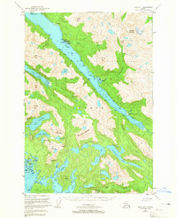
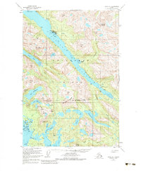
1951 Map of Sitka D-7
USGS Topo · Published 1965About this map
Lisianski Inlet carves a deep passage through the northwestern reaches of Chichagof Island, anchoring the fishing and processing hub of Pelican. This 1951 survey, with revisions to 1965, documents a landscape where maritime transport is the primary connector, evidenced by the Pelican Seaplane Base and the lack of traditional roads between settlements like Sunnyside and the remote Logging Camp further down the inlet.
Find a feature on this map
65 named features on this map. Tap any name to fly to it.
Don’t see what you’re looking for? This feature index may not catch every label — zoom into the map to look around manually.
Map Details
Editions of this 1951 Sitka D-7 Map
6 editions found
Other maps of this area

1948 · Sitka C-7
USGS Topo · 1:63,360

1948 · Mount Fairweather A-2
USGS Topo · 1:63,360

1948 · Sitka C-6
USGS Topo · 1:63,360

1948 · Sitka D-6
USGS Topo · 1:63,360

1948 · Sitka D-8
USGS Topo · 1:63,360

1948 · Mount Fairweather A-1
USGS Topo · 1:63,360

1950 · Sitka D-8
USGS Topo · 1:63,360

1951 · Juneau
USGS Topo · 1:250,000

1951 · Juneau A-6
USGS Topo · 1:63,360

1951 · Sitka D-7
USGS Topo · 1:63,360