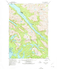
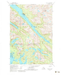
1951 Map of Sitka D-7
USGS Topo · Published 1975About this map
The boardwalk community of Pelican serves as the focal point of this Chichagof Island survey, established along the steep-walled Lisianski Inlet. By the mid-20th century, the area supported a specialized coastal economy evidenced by the Seaplane Base and a Logging Camp, while the extraction industry is represented by the Apex Mine and El Nido Mine situated near Cann Creek. The terrain is characterized by a dense network of freshwater systems, including the Goulding Lakes, which feed into the intricate waterways of Portlock Harbor. Navigation and settlement patterns are dictated by the dramatic maritime topography, where landmarks like Sunnyside and Mirror Hbr cling to the shoreline beneath peaks such as Wedge Mtn and Apex Mtn. The map also delineates the northern boundary of the City and Borough of Sitka, illustrating the administrative reach into the Tongass National Forest.
Find a feature on this map
56 named features on this map. Tap any name to fly to it.
Don’t see what you’re looking for? This feature index may not catch every label — zoom into the map to look around manually.
Map Details
Editions of this 1951 Sitka D-7 Map
6 editions found
Other maps of this area

1948 · Sitka C-7
USGS Topo · 1:63,360

1948 · Mount Fairweather A-2
USGS Topo · 1:63,360

1948 · Sitka C-6
USGS Topo · 1:63,360

1948 · Sitka D-6
USGS Topo · 1:63,360

1948 · Sitka D-8
USGS Topo · 1:63,360

1948 · Mount Fairweather A-1
USGS Topo · 1:63,360

1950 · Sitka D-8
USGS Topo · 1:63,360

1951 · Juneau
USGS Topo · 1:250,000

1951 · Juneau A-6
USGS Topo · 1:63,360

1951 · Sitka D-7
USGS Topo · 1:63,360