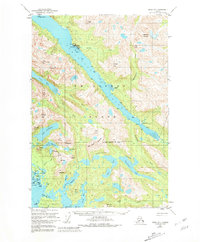
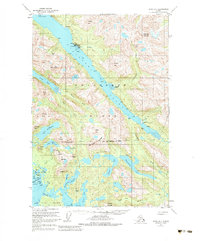
1951 Map of Sitka D-7
USGS Topo · Published 1981About this map
Pelican serves as the primary coastal hub on this mid-century survey of Chichagof Island, situated along the eastern shore of Lisianski Inlet. The mapping highlights a remote maritime and industrial landscape, specifically noting the Lisianski Inlet Seaplane Base and the small settlement at Sunnyside. Inland, the economy of the era is evident through the Apex Mine and El Nido Mine located near Apex Mtn, while Mine Mtn stands further south toward the City and Borough of Sitka boundary.
Find a feature on this map
86 named features on this map. Tap any name to fly to it.
Don’t see what you’re looking for? This feature index may not catch every label — zoom into the map to look around manually.
Map Details
Editions of this 1951 Sitka D-7 Map
6 editions found
Other maps of this area

1948 · Sitka C-7
USGS Topo · 1:63,360

1948 · Mount Fairweather A-2
USGS Topo · 1:63,360

1948 · Sitka C-6
USGS Topo · 1:63,360

1948 · Sitka D-6
USGS Topo · 1:63,360

1948 · Sitka D-8
USGS Topo · 1:63,360

1948 · Mount Fairweather A-1
USGS Topo · 1:63,360

1950 · Sitka D-8
USGS Topo · 1:63,360

1951 · Juneau
USGS Topo · 1:250,000

1951 · Juneau A-6
USGS Topo · 1:63,360

1951 · Sitka D-7
USGS Topo · 1:63,360