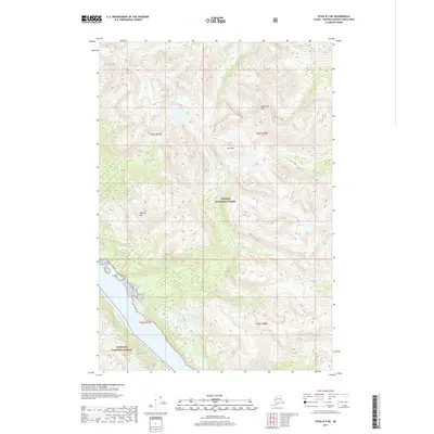
2017 Map of Sitka D-7 NE
USGS Topo · Published 2017About this map
Tongass National Forest dominates this coastal Alaskan landscape, where the Chichagof Island interior rises sharply from the Pacific shoreline into a series of high ridges and named peaks. The terrain is defined by dramatic elevation changes, notably at Mineral Mtn and Pegmatite Mtn, which suggest the region's geological makeup and potential for mineral prospecting. Between these heights, Pass Mtn provides a natural corridor above the drainage basins. Water flows from the steep slopes through systems like Phonograph Cr and Pelican Cr, which carve narrow valleys through the forest on their way toward the sea. This 2017 survey illustrates the intersection of maritime geography and dense, high-latitude forest before reaching the open water of the sound.
Find a feature on this map
10 named features on this map. Tap any name to fly to it.
Don’t see what you’re looking for? This feature index may not catch every label — zoom into the map to look around manually.
Map Details
Editions of this 2017 Sitka D-7 NE Map
This is the sole edition of this map. No revisions or reprints were ever made.
Other maps of this area

1948 · Sitka D-6
USGS Topo · 1:63,360

1948 · Mount Fairweather A-1
USGS Topo · 1:63,360

1951 · Juneau
USGS Topo · 1:250,000

1951 · Juneau A-6
USGS Topo · 1:63,360

1951 · Sitka D-7
USGS Topo · 1:63,360

1951 · Mt Fairweather
USGS Topo · 1:250,000

1951 · Sitka
USGS Topo · 1:250,000

1951 · Sitka D-6
USGS Topo · 1:63,360

1952 · Sitka
USGS Topo · 1:250,000

1954 · Mount Fairweather A-1
USGS Topo · 1:63,360