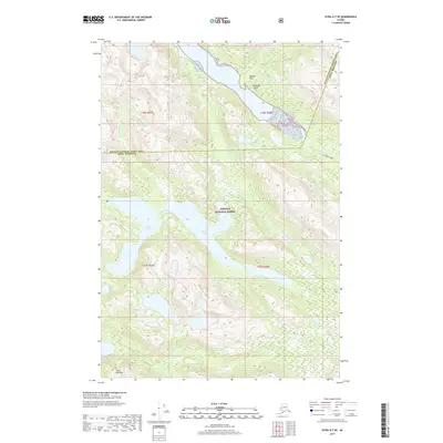
2017 Map of Sitka D-7 SE
USGS Topo · Published 2017About this map
Tongass National Forest dominates this coastal Alaskan landscape, where the intricate network of glacial valleys and waterways defines the wilderness. The terrain is characterized by high peaks such as Goon Dip Mtn and the low-lying glacial deposit area of Soloma Flat near Soloma Point. The map illustrates a complex drainage system, featuring the Steelhead River and the Lisianski River, which feed into various inlets and bays. Notable freshwater bodies including Otter Lake and Goulding Lake sit within the heavily forested interior. This 2017 survey details the intersection of the Sitka Borough and the Hoonah-Angoon Census Area, providing a clear look at the undeveloped coastline and its natural drainage patterns via the Goon Dip River and Goulding River.
Find a feature on this map
15 named features on this map. Tap any name to fly to it.
Don’t see what you’re looking for? This feature index may not catch every label — zoom into the map to look around manually.
Map Details
Editions of this 2017 Sitka D-7 SE Map
This is the sole edition of this map. No revisions or reprints were ever made.
Other maps of this area

1948 · Sitka C-7
USGS Topo · 1:63,360

1948 · Sitka C-6
USGS Topo · 1:63,360

1948 · Sitka D-6
USGS Topo · 1:63,360

1951 · Sitka D-7
USGS Topo · 1:63,360

1951 · Sitka
USGS Topo · 1:250,000

1951 · Sitka C-6
USGS Topo · 1:63,360

1951 · Sitka C-7
USGS Topo · 1:63,360

1951 · Sitka D-6
USGS Topo · 1:63,360

1952 · Sitka
USGS Topo · 1:250,000

1964 · Sitka
USGS Topo · 1:250,000