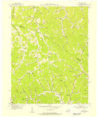
1954 Map of Sitka
USGS Topo · Published 1955About this map
Davisville and Sitka anchor this mid-century survey of the Appalachian foothills along the Lawrence County and Johnson County line. The landscape is defined by an intricate network of narrow hollows and winding creek forks, where small rural settlements like Winifred, Chandlerville, and Stambaugh thrived away from the major valley centers. This 1950s documentation reveals a dense distribution of social infrastructure, including the Nancy Castle Memorial School and Little Gap Union Church, which served families tucked into the hills. Transportation relies on the winding courses of Georges Creek and Hood Creek, while the presence of a Lookout Tower and Kerz Post Office highlights the era's local communication and fire-watch network. The map preserves the names of numerous family-linked landmarks, from Rocky Point to the Lettered Rocks on the Lick Fork.
Find a feature on this map
83 named features on this map. Tap any name to fly to it.
Don’t see what you’re looking for? This feature index may not catch every label — zoom into the map to look around manually.
Map Details
Editions of this 1954 Sitka Map
2 editions found
Other maps of this area

1886 · Prestonsburg
USGS Topo · 1:125,000

1892 · Prestonsburg
USGS Topo · 1:125,000

1903 · Kenova
USGS Topo · 1:125,000

1904 · Kenova
USGS Topo · 1:125,000

1911 · Louisa
USGS Topo · 1:48,000

1913 · Louisa
USGS Topo · 1:62,500

1914 · Inez
USGS Topo · 1:48,000

1915 · Paintsville
USGS Topo · 1:48,000

1916 · Inez
USGS Topo · 1:62,500

1917 · Paintsville
USGS Topo · 1:62,500