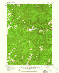
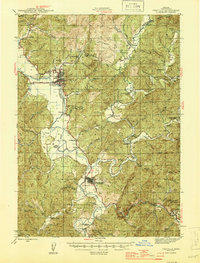
1955 Map of Sitkum
USGS Topo · Published 1960About this map
The East Fork Coquille River and Middle Fork Coquille River carve through the heavily forested terrain of Coos and Douglas Counties, defining the drainage patterns and transportation corridors of the mid-1950s. The small settlement of Sitkum serves as a central point along the river, flanked by smaller outposts like Dora and Remote. This era of land management is clearly visible through the network of fire lookouts, including Brewster Lookout atop Brewster Rock and the Sitkum Lookout, which monitored the timberlands before modern aerial surveillance became standard.
Find a feature on this map
31 named features on this map. Tap any name to fly to it.
Don’t see what you’re looking for? This feature index may not catch every label — zoom into the map to look around manually.
Map Details
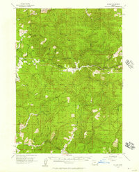
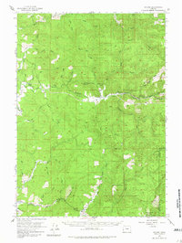
Editions of this 1955 Sitkum Map
3 editions found
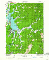
Other maps of this area

1896 · Coos Bay
USGS Topo · 1:125,000

1898 · Coos Bay
USGS Topo · 1:125,000

1899 · Port Orford
USGS Topo · 1:125,000

1900 · Coos Bay
USGS Topo · 1:125,000

1903 · Port Orford
USGS Topo · 1:125,000

1928 · Sitkum
USGS Topo · 1:125,000

1942 · Coquille
USGS Topo · 1:62,500
1942 · Coos Bay
USGS Topo · 1:62,500
1945 · Coquille
USGS Topo · 1:62,500
1945 · Coos Bay
USGS Topo · 1:62,500