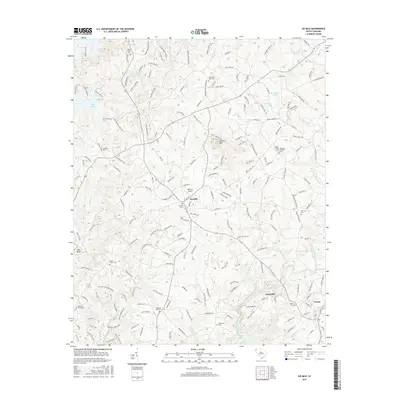
2017 Map of Six Mile
USGS Topo · Published 2017About this map
Six Mile and the surrounding Pickens County landscape are defined by a complex network of creeks and small ridges. The topography is dominated by the prominent Sixmile Mtn, while the western edge of the area is transformed by the waters of Lake Keowee. Numerous family and community burial grounds, such as Boroughs-Gillespie Cem, Kings Grove Cem, and Welcome Cem, are scattered across the terrain, reflecting generations of local settlement. The transition from rural foothills to small industrial and residential centers is visible in the proximity of Cateechee and Norris. Transportation patterns are evidenced by the presence of the Oakview Airport and an extensive network of named roads and specialized trails, including the Pot Belly Pig Logging Road and Wildcat Technical trail, suggesting a modern landscape that balances residential living with active forestry and recreation.
Find a feature on this map
190 named features on this map. Tap any name to fly to it.
Don’t see what you’re looking for? This feature index may not catch every label — zoom into the map to look around manually.
Map Details
Editions of this 2017 Six Mile Map
This is the sole edition of this map. No revisions or reprints were ever made.
Other maps of this area

1888 · Pickens
USGS Topo · 1:125,000

1894 · Pickens
USGS Topo · 1:125,000

1951 · Clemson
USGS Topo · 1:24,000

1954 · Greenville
USGS Topo · 1:250,000

1957 · Anderson
USGS Topo · 1:62,500

1957 · Easley
USGS Topo · 1:62,500

1958 · Greenville
USGS Topo · 1:250,000

1958 · Seneca
USGS Topo · 1:24,000

1959 · Salem
USGS Topo · 1:24,000
1961 · Sunset
USGS Topo · 1:24,000