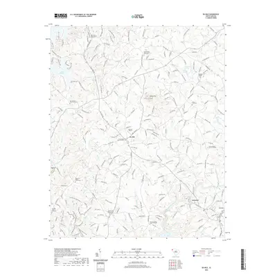
2020 Map of Six Mile
USGS Topo · Published 2020About this map
Six Mile sits central in this Upstate South Carolina landscape, characterized by the undulating terrain of the Piedmont and the prominent elevation of Sixmile Mtn. The area is densely patterned with rural religious and community markers, including Six Mile Baptist Church, Mountain View Baptist Church, and the Boroughs Gillespie Cem. Water defines the western and eastern boundaries, with the expansive Lake Keowee and Mile Cr Lake to the west, while the waters of Twelvemile Creek and Praters Cr carve through the eastern hills.
Find a feature on this map
215 named features on this map. Tap any name to fly to it.
Don’t see what you’re looking for? This feature index may not catch every label — zoom into the map to look around manually.
Map Details
Editions of this 2020 Six Mile Map
This is the sole edition of this map. No revisions or reprints were ever made.
Other maps of this area

1888 · Pickens
USGS Topo · 1:125,000

1894 · Pickens
USGS Topo · 1:125,000

1951 · Clemson
USGS Topo · 1:24,000

1954 · Greenville
USGS Topo · 1:250,000

1957 · Anderson
USGS Topo · 1:62,500

1957 · Easley
USGS Topo · 1:62,500

1958 · Greenville
USGS Topo · 1:250,000

1958 · Seneca
USGS Topo · 1:24,000

1959 · Salem
USGS Topo · 1:24,000
1961 · Sunset
USGS Topo · 1:24,000