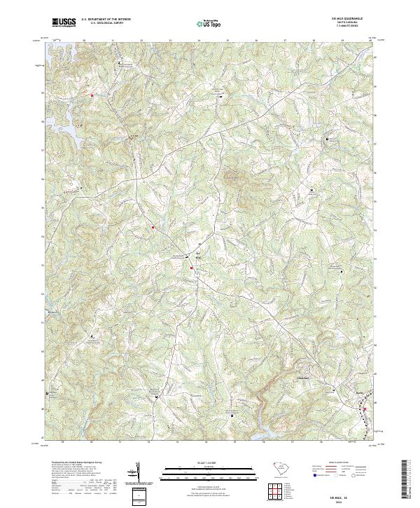
2024 Map of Six Mile
USGS Topo · Published 2024About this map
Six Mile serves as the central hub of this Pickens County landscape, situated amidst a terrain defined by the winding paths of Twelvemile Creek and its many tributaries. The area is characterized by a high density of rural religious and funerary sites, reflecting a deep-seated community history centered around congregations such as Gap Hill Baptist Church and Welcome Baptist Church. To the south, the settlements of Cateechee and Norris sit near the banks of the Blue Branch, where the landscape transitions into a more intricate network of local roads and family-named landmarks.
Find a feature on this map
211 named features on this map. Tap any name to fly to it.
Don’t see what you’re looking for? This feature index may not catch every label — zoom into the map to look around manually.
Map Details
Editions of this 2024 Six Mile Map
This is the sole edition of this map. No revisions or reprints were ever made.
Other maps of this area

1888 · Pickens
USGS Topo · 1:125,000

1894 · Pickens
USGS Topo · 1:125,000

1951 · Clemson
USGS Topo · 1:24,000

1954 · Greenville
USGS Topo · 1:250,000

1957 · Anderson
USGS Topo · 1:62,500

1957 · Easley
USGS Topo · 1:62,500

1958 · Greenville
USGS Topo · 1:250,000

1958 · Seneca
USGS Topo · 1:24,000

1959 · Salem
USGS Topo · 1:24,000
1961 · Sunset
USGS Topo · 1:24,000