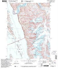
2004 Map of Skagway A-1
USGS Topo · Published 2007About this map
Meade Glacier dominates the northeastern reaches of this landscape, its massive presence carving the high terrain of the Coast Mountains within the Tongass National Forest. The map documents the intricate coastline where the Lynn Canal meets Chilkat Inlet, a critical waterway served by the Alaska Marine Highway. Maritime safety is emphasized by the presence of Battery Pt Light and Eldred Rock Light, marking the transition from open water to the sheltered coves near Kelgaya Point.
Find a feature on this map
53 named features on this map. Tap any name to fly to it.
Don’t see what you’re looking for? This feature index may not catch every label — zoom into the map to look around manually.
Map Details
Editions of this 2004 Skagway A-1 Map
This is the sole edition of this map. No revisions or reprints were ever made.
Other maps of this area

1948 · Juneau D-3
USGS Topo · 1:63,360

1948 · Skagway A-1
USGS Topo · 1:63,360

1949 · Atlin
USGS Topo · 1:250,000

1949 · Juneau D-5
USGS Topo · 1:63,360

1949 · Skagway B-1
USGS Topo · 1:63,360

1949 · Juneau D-4
USGS Topo · 1:63,360

1949 · Juneau D-3
USGS Topo · 1:63,360

1951 · Juneau
USGS Topo · 1:250,000

1951 · Skagway A-1
USGS Topo · 1:63,360

1951 · Atlin
USGS Topo · 1:250,000