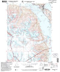
2004 Map of Skagway A-2
USGS Topo · Published 2007About this map
Haines serves as the focal point of this maritime and alpine landscape, situated on a narrow isthmus between Chilkoot Inlet and Chilkat Inlet. The settlement pattern reflects the area's transition from indigenous sites like Yindastuki and Deshu to the established community at Port Chilkoot. Infrastructure such as the Haines Highway and the Haines Municipal Airport connect this coastal hub to the interior, while the Alaska Marine Highway provides essential seafaring access through Portage Cove.
Find a feature on this map
55 named features on this map. Tap any name to fly to it.
Don’t see what you’re looking for? This feature index may not catch every label — zoom into the map to look around manually.
Map Details
Editions of this 2004 Skagway A-2 Map
This is the sole edition of this map. No revisions or reprints were ever made.
Other maps of this area

1948 · Skagway A-1
USGS Topo · 1:63,360

1949 · Juneau D-6
USGS Topo · 1:63,360

1949 · Juneau D-5
USGS Topo · 1:63,360

1949 · Skagway B-1
USGS Topo · 1:63,360

1951 · Juneau
USGS Topo · 1:250,000

1951 · Skagway A-1
USGS Topo · 1:63,360

1951 · Skagway B-1
USGS Topo · 1:63,360

1952 · Skagway
USGS Topo · 1:250,000

1954 · Skagway B-2
USGS Topo · 1:63,360

1954 · Skagway A-3
USGS Topo · 1:63,360