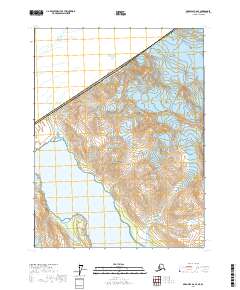
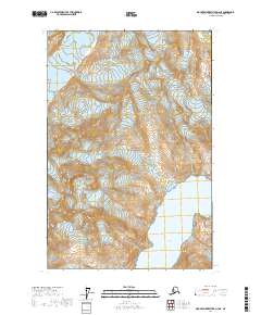
2017 Map of Skagway A-6 SE
USGS Topo · Published 2017About this map
Glacier Bay National Park dominates this high-latitude survey, capturing a landscape defined by massive ice formations and the international boundary between Alaska and Canada. The rugged terrain is anchored by Mt Barnard on the northern border, where the ice-fields feed into significant glacial systems. The interaction of land and sea is most prominent at Tarr Inlet, where the Margerie Glacier meets the tidewater. This 2017 study illustrates the modern extent of these glacial features, including the Rendu Glacier to the east, providing a precise topographic record of the shifting ice and water margins within the protected wilderness area.
Find a feature on this map
12 named features on this map. Tap any name to fly to it.
Don’t see what you’re looking for? This feature index may not catch every label — zoom into the map to look around manually.
Map Details
Editions of this 2017 Skagway A-6 SE Map
This is the sole edition of this map. No revisions or reprints were ever made.
Other maps of this area

1951 · Mt Fairweather
USGS Topo · 1:250,000

1952 · Skagway
USGS Topo · 1:250,000

1961 · Mount Fairweather D-4
USGS Topo · 1:63,360
1961 · Skagway A-6
USGS Topo · 1:63,360
1961 · Skagway A-5
USGS Topo · 1:63,360

1961 · Mount Fairweather D-3
USGS Topo · 1:63,360

1961 · Mt Fairweather
USGS Topo · 1:250,000

1961 · Skagway
USGS Topo · 1:250,000
2017 · Skagway A-5 SW
USGS Topo · 1:25,000
2017 · Mount Fairweather D-4 NE
USGS Topo · 1:25,000