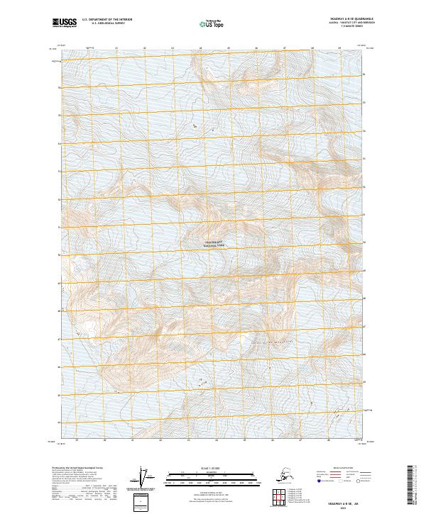
2021 Map of Skagway A-8 SE
USGS Topo · Published 2021About this map
Glacier Bay National Park dominates this 2021 topographic study, capturing a high-altitude landscape within the Saint Elias Mountains. The map provides a detailed view of the massive Grand Plateau Glacier, documenting the ice and snow coverage across this protected wilderness near the Alaskan coast. This contemporary survey serves as a vital record of the glaciated terrain within the Yakutat City and Borough, illustrating the immense scale of the mountain ranges and the ice fields that characterize the region. The absence of roads, settlements, or infrastructure highlights the preserved, wild state of this portion of the national park, where the topography is defined entirely by natural elevation and glacial movement.
Find a feature on this map
10 named features on this map. Tap any name to fly to it.
Don’t see what you’re looking for? This feature index may not catch every label — zoom into the map to look around manually.
Map Details
Editions of this 2021 Skagway A-8 SE Map
This is the sole edition of this map. No revisions or reprints were ever made.
Other maps of this area

1951 · Mt Fairweather
USGS Topo · 1:250,000

1952 · Skagway
USGS Topo · 1:250,000

1961 · Skagway A-7
USGS Topo · 1:63,360

1961 · Mount Fairweather D-6
USGS Topo · 1:63,360

1961 · Mount Fairweather D-5
USGS Topo · 1:63,360

1961 · Skagway A-8
USGS Topo · 1:63,360

1961 · Mt Fairweather
USGS Topo · 1:250,000

1961 · Skagway
USGS Topo · 1:250,000
2017 · Mount Fairweather D-5 NW
USGS Topo · 1:25,000
2017 · Mount Fairweather D-6 NE
USGS Topo · 1:25,000