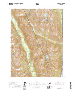
2017 Map of Skagway B-2 NE
USGS Topo · Published 2017About this map
Ferebee River carves a broad valley through the high country where the Haines Borough and Skagway Municipality borders meet. The terrain is defined by dramatic elevation changes, rising from the glacial waters of the Taiya Inlet in the southeast corner up to the prominent peaks of Mt Harding and Face Mtn. This 2017 survey illustrates the hydrological network of the region, including the drainages of Nelson Cr and Burro Cr as they navigate the steep slopes. The lack of roads or infrastructure underscores the wilderness character of this Alaskan landscape, where township lines like t28s r58e and t28s r59e provide the only human-imposed structure across the glaciated valleys and mountain ridges.
Find a feature on this map
14 named features on this map. Tap any name to fly to it.
Don’t see what you’re looking for? This feature index may not catch every label — zoom into the map to look around manually.
Map Details
Editions of this 2017 Skagway B-2 NE Map
This is the sole edition of this map. No revisions or reprints were ever made.
Other maps of this area

1948 · Skagway C-2
USGS Topo · 1:63,360

1948 · Skagway C-1
USGS Topo · 1:63,360

1949 · Skagway B-1
USGS Topo · 1:63,360

1951 · Skagway C-1
USGS Topo · 1:63,360

1951 · Skagway B-1
USGS Topo · 1:63,360

1951 · Skagway C-2
USGS Topo · 1:63,360

1952 · Skagway
USGS Topo · 1:250,000

1954 · Skagway B-2
USGS Topo · 1:63,360

1961 · Skagway
USGS Topo · 1:250,000
1991 · Skagway B-2 SW
USGS Topo · 1:25,000