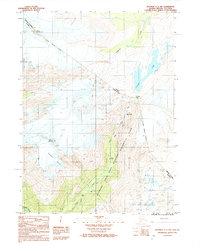
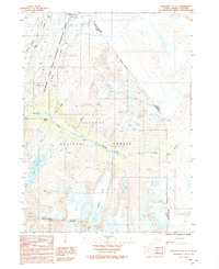
1992 Map of Skagway C-1 NW
USGS Topo · Published 1992About this map
Klondike Gold Rush National Historical Park anchors this 1990s survey, documenting the legendary transit corridor between Alaska and British Columbia. The map provides a detailed look at the challenging ascent toward the Canada-United States border, centered on the arduous trek through Chilkoot Pass. Historic transit stops such as Sheep Camp and Pleasant Camp sit alongside the Taiya River Trail, marking the traditional path of stampeders. The geography is defined by high alpine features including Mount Van Wagenen and the Saussure Glacier, which emphasize the physical barriers faced by early travelers. The presence of The Scales (Site) serves as a reminder of the logistical hurdles encountered at the base of the final climb, while the headwaters of Lindeman Creek and the expanse of Crater Lake indicate the shift toward the interior waterways of the Yukon drainage.
Find a feature on this map
18 named features on this map. Tap any name to fly to it.
Don’t see what you’re looking for? This feature index may not catch every label — zoom into the map to look around manually.
Map Details
Editions of this 1992 Skagway C-1 NW Map
This is the sole edition of this map. No revisions or reprints were ever made.
Other maps of this area

1948 · Skagway C-2
USGS Topo · 1:63,360

1948 · Skagway C-1
USGS Topo · 1:63,360
1949 · Skagway D-2
USGS Topo · 1:63,360

1951 · Skagway C-1
USGS Topo · 1:63,360

1951 · Skagway C-2
USGS Topo · 1:63,360

1952 · Skagway
USGS Topo · 1:250,000

1961 · Skagway
USGS Topo · 1:250,000
1991 · Skagway C-1 SW
USGS Topo · 1:25,000
1992 · Skagway C-1 NE
USGS Topo · 1:25,000
1992 · Skagway C-1 SE
USGS Topo · 1:25,000