1992 Map of Skagway C-1 NE
USGS Topo · Published 1992About this map
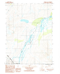
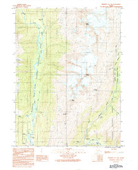
White Pass serves as the focal point for this transboundary survey, marking the historic gateway between Alaska and British Columbia. This high-altitude corridor is defined by the parallel routes of the White Pass and Yukon Route narrow gauge railroad and the modern Klondike Highway, both of which navigate the steep terrain adjacent to Summit Lake. The map illustrates a complex network of glacial hydrology, with the Tutshi River flowing north through Bernard Lake and toward Shallow Lake. Within the Klondike Gold Rush National Historical Park, the landscape preserves the legacy of the late 19th-century gold seekers. The small settlement at Fraser stands as a rare outpost of human activity in this alpine environment, while the northern extent of the Chilkoot Trail appears on the western edge, providing a detailed look at the footpaths and infrastructure that connect the coast to the interior.
Find a feature on this map
13 named features on this map. Tap any name to fly to it.
Don’t see what you’re looking for? This feature index may not catch every label — zoom into the map to look around manually.
Map Details
Editions of this 1992 Skagway C-1 NE Map
This is the sole edition of this map. No revisions or reprints were ever made.
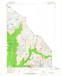
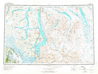
Other maps of this area
1948 · Skagway C-1
USGS Topo · 1:63,360

1949 · Atlin
USGS Topo · 1:250,000
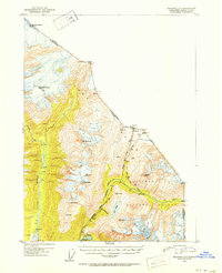
1951 · Skagway C-1
USGS Topo · 1:63,360

1951 · Atlin
USGS Topo · 1:250,000

1952 · Skagway
USGS Topo · 1:250,000
1960 · Atlin
USGS Topo · 1:250,000

1961 · Skagway
USGS Topo · 1:250,000
1991 · Skagway C-1 SW
USGS Topo · 1:25,000
1992 · Skagway C-1 NW
USGS Topo · 1:25,000
1992 · Skagway C-1 SE
USGS Topo · 1:25,000