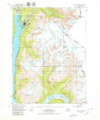
1949 Map of Skagway B-1
USGS Topo · Published 1980About this map
Skagway and its neighbor Dyea are the focal points of this mid-century survey, sitting at the head of the Taiya Inlet in a landscape defined by the legacies of the gold rush. The logistics of the era are visible through the White Pass and Yukon Route railway, a Ferry Terminal, and a Landing Strip serving this gateway to the interior. The map illustrates the town's position between the Taiya River and the precipitous slopes of Twin Dewey Peaks, with numerous hydrological features like Lower Dewey Lake and Reid Falls tucked into the mountain folds.
Find a feature on this map
35 named features on this map. Tap any name to fly to it.
Don’t see what you’re looking for? This feature index may not catch every label — zoom into the map to look around manually.
Map Details
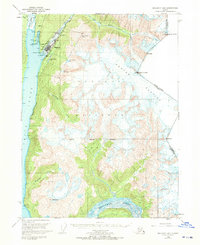
Editions of this 1949 Skagway B-1 Map
3 editions found
Other maps of this area

1948 · Skagway C-2
USGS Topo · 1:63,360

1948 · Skagway A-1
USGS Topo · 1:63,360

1948 · Skagway C-1
USGS Topo · 1:63,360

1949 · Atlin
USGS Topo · 1:250,000

1949 · Skagway B-1
USGS Topo · 1:63,360

1951 · Skagway A-1
USGS Topo · 1:63,360

1951 · Skagway C-1
USGS Topo · 1:63,360

1951 · Atlin
USGS Topo · 1:250,000

1951 · Skagway B-1
USGS Topo · 1:63,360

1951 · Skagway C-2
USGS Topo · 1:63,360