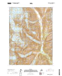
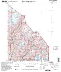
2017 Map of Skagway C-2 NE
USGS Topo · Published 2017About this map
The Nourse River winds through this mountainous corridor of Southeast Alaska, defining the primary drainage system for the steep valleys of the Skagway Municipality. This survey documents a critical geopolitical threshold where the high-altitude terrain meets the international boundary between Alaska and Canada. The landscape is dominated by extreme relief, illustrated by dense contour intervals that trace the sharp ascent toward the Usa and Canadian border. This map serves as a modern record of the glaciated valleys and hydrological patterns of the northern Panhandle, providing precise data for the drainage basins and remote municipal boundaries at the edge of the wilderness.
Find a feature on this map
8 named features on this map. Tap any name to fly to it.
Don’t see what you’re looking for? This feature index may not catch every label — zoom into the map to look around manually.
Map Details
Editions of this 2017 Skagway C-2 NE Map
This is the sole edition of this map. No revisions or reprints were ever made.
Other maps of this area

1948 · Skagway C-2
USGS Topo · 1:63,360

1948 · Skagway C-1
USGS Topo · 1:63,360
1949 · Skagway D-2
USGS Topo · 1:63,360

1951 · Skagway C-1
USGS Topo · 1:63,360

1951 · Skagway C-2
USGS Topo · 1:63,360

1952 · Skagway
USGS Topo · 1:250,000

1961 · Skagway
USGS Topo · 1:250,000
1991 · Skagway C-1 SW
USGS Topo · 1:25,000
1992 · Skagway C-1 NW
USGS Topo · 1:25,000
2004 · Skagway C-1
USGS Topo · 1:63,360