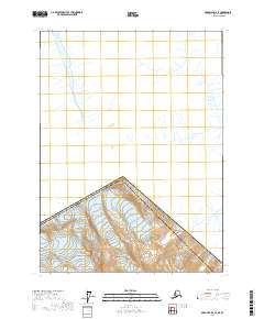
2017 Map of Skagway D-2 SE
USGS Topo · Published 2017About this map
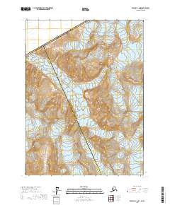
Mt Foster towers over the northern international border in this high-altitude landscape where the Canada United States of America boundary slices across the terrain. Located within the Skagway Municipality, the map highlights the rigid surveying lines of Alaska township and range sections t24s r57e and t24s r58e. The cartography emphasizes the intricate drainage patterns and sharp elevation changes defined by numerous unnamed glacial streams and ridges that define this portion of the northern Panhandle. The interplay between the international boundary and the Public Land Survey System creates a distinct grid over a largely untouched wilderness, providing an exact record of political and geographic divisions in the early twenty-first century.
Find a feature on this map
6 named features on this map. Tap any name to fly to it.
Don’t see what you’re looking for? This feature index may not catch every label — zoom into the map to look around manually.
Map Details
Editions of this 2017 Skagway D-2 SE Map
This is the sole edition of this map. No revisions or reprints were ever made.
Other maps of this area

1948 · Skagway C-2
USGS Topo · 1:63,360

1948 · Skagway C-1
USGS Topo · 1:63,360
1949 · Skagway D-2
USGS Topo · 1:63,360

1951 · Skagway C-1
USGS Topo · 1:63,360

1951 · Skagway C-2
USGS Topo · 1:63,360

1952 · Skagway
USGS Topo · 1:250,000

1961 · Skagway
USGS Topo · 1:250,000
1992 · Skagway C-1 NW
USGS Topo · 1:25,000
2004 · Skagway C-1
USGS Topo · 1:63,360
2017 · Skagway C-2 NW
USGS Topo · 1:25,000