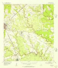
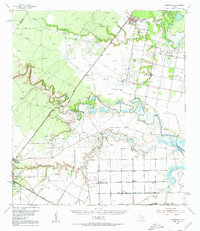
1954 Map of Skidmore
USGS Topo · Published 1956About this map
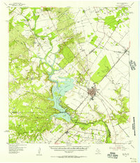
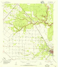
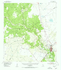
Chase Field Naval Air Station dominates the central landscape of Bee County in the mid-1950s, a significant military installation situated between the city of Beeville and the town of Skidmore. The terrain is defined by the winding course of the Aransas River and its many tributaries, including Poesta Creek and Medio Creek. This era of the Coastal Bend region shows a transition from traditional ranching and agriculture to industrial development, marked by the Rock Hill Oil Field and the Texas A & M College Agricultural Experimental Substation No 1. Local history is preserved through scattered rural schools like Poesta Sch and Leaf Smith Sch, along with numerous family and community landmarks such as the Heard Ranch and the enigmatic Lost Boy Monument. The Texas and New Orleans Railroad provides the primary industrial artery, connecting these South Texas settlements.
Find a feature on this map
47 named features on this map. Tap any name to fly to it.
Don’t see what you’re looking for? This feature index may not catch every label — zoom into the map to look around manually.
Map Details
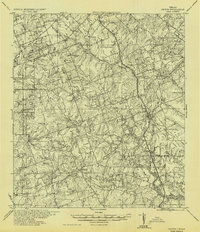
Editions of this 1954 Skidmore Map
2 editions found
Other maps of this area

1927 · Mathis
USGS Topo · 1:62,500
1936 · Pettus
USGS Topo · 1:62,500

1953 · Beeville
USGS Topo · 1:250,000
1954 · Skidmore
USGS Topo · 1:62,500
1954 · Fleming
USGS Topo · 1:62,500
1954 · Woodsboro
USGS Topo · 1:62,500
1954 · Mathis
USGS Topo · 1:62,500
1954 · Sinton
USGS Topo · 1:62,500
1954 · Refugio
USGS Topo · 1:62,500

1956 · Beeville
USGS Topo · 1:250,000
Featured Places
- Beeville, TX
- Yougeen, TX
- Old Houston Highway Colonia, TX
- Skidmore, TX
- 1st, 2nd, and 3rd Street Area Colonia, TX