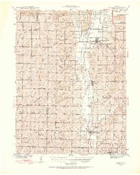
1939 Map of Skidmore
USGS Topo · Published 1952About this map
The Nodaway River valley defines this agrarian landscape, which was surveyed in the 1920s and 1930s. The region is marked by a dense grid of country schools, such as Little Brick Sch, Possum Walk Sch, and the uniquely named Hedge College Sch, reflecting the community structure of early 20th-century Missouri. The local economy and travel are centered around the Chicago Burlington & Quincy RR and Chicago Great Western RR, which connect the primary settlements of Burlington Junction, Quitman, and Skidmore. Beyond the river, the terrain is etched by numerous branches including Hagey Branch and Florida Creek. Genealogists may find interest in St Oswald Ch and the Skidmore Cem, as well as several smaller family-named landmarks like Minnesota Valley and Sand Creek that reveal the deep ties between the residents and their land.
Find a feature on this map
65 named features on this map. Tap any name to fly to it.
Don’t see what you’re looking for? This feature index may not catch every label — zoom into the map to look around manually.
Map Details
Editions of this 1939 Skidmore Map
3 editions found
Other maps of this area

1920 · Craig
USGS Topo · 1:62,500

1926 · Maitland
USGS Topo · 1:62,500

1927 · Bolckow
USGS Topo · 1:62,500

1939 · Tarkio
USGS Topo · 1:62,500

1939 · Farragut
USGS Topo · 1:62,500

1939 · Skidmore
USGS Topo · 1:62,500

1940 · Tarkio
USGS Topo · 1:62,500

1940 · Farragut
USGS Topo · 1:62,500

1940 · Coin
USGS Topo · 1:62,500

1940 · New Market
USGS Topo · 1:62,500