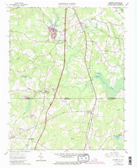
1963 Map of Skippers
USGS Topo · Published 1980About this map
Seaboard Coast Line tracks slice through the coastal plain of Greensville County, marking a landscape defined by traditional crossroads settlements and slow-moving swamp drainage. The community of Skippers sits near the northern edge of the sheet, while the interstate age is visibly emerging with the path of Interstate 95 and its associated Rest Area. This 1963 survey, revised in 1979, illustrates a transitional period as local travel patterns shifted from rural hubs like Turners Crossroads and Dahlia toward the modern corridor.
Find a feature on this map
33 named features on this map. Tap any name to fly to it.
Don’t see what you’re looking for? This feature index may not catch every label — zoom into the map to look around manually.
Map Details
Editions of this 1963 Skippers Map
Other maps of this area

1919 · Emporia
USGS Topo · 1:62,500

1919 · Arringdale
USGS Topo · 1:48,000

1920 · Arringdale
USGS Topo · 1:62,500

1942 · Arringdale
USGS Topo · 1:62,500

1942 · Emporia
USGS Topo · 1:62,500

1953 · Norfolk
USGS Topo · 1:250,000

1963 · Skippers
USGS Topo · 1:24,000

1963 · Barley
USGS Topo · 1:24,000

1963 · Emporia
USGS Topo · 1:24,000

1963 · Ante
USGS Topo · 1:24,000