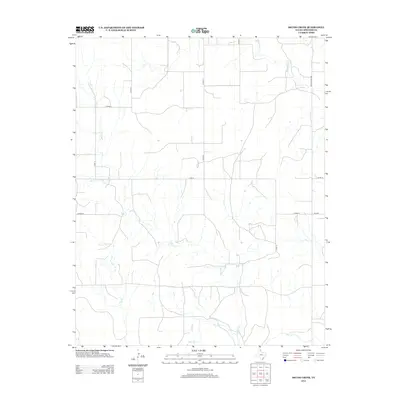
2012 Map of Skunk Creek
USGS Topo · Published 2012About this map
Wolf Cr and its tributaries define the drainage of this High Plains landscape in northeastern Lipscomb County. This 2012 survey documents a sparsely settled ranching and agricultural region, where the grid-based road network provides essential access to the expansive terrain. Key watercourses such as Skunk Cr, Cat Cr, and Mammoth Cr cross the plains, indicating the natural flow towards larger river systems. The transportation infrastructure is characterized by several county roads like Co Rd 21 and Co Road L, alongside state-maintained routes including FM-3004 and Ranch Road 1454. This map illustrates the intersection of natural hydrology and the systematic organization of the Texas Panhandle, showing how land use and movement are channeled along these established water and road corridors.
Find a feature on this map
14 named features on this map. Tap any name to fly to it.
Don’t see what you’re looking for? This feature index may not catch every label — zoom into the map to look around manually.
Map Details
Editions of this 2012 Skunk Creek Map
This is the sole edition of this map. No revisions or reprints were ever made.
Other maps of this area

1954 · Perryton
USGS Topo · 1:250,000

1958 · Perryton
USGS Topo · 1:250,000

1972 · Follett SE
USGS Topo · 1:24,000

1972 · Dugout Creek
USGS Topo · 1:24,000

1972 · Skunk Creek
USGS Topo · 1:24,000
1972 · Magoun
USGS Topo · 1:24,000

1972 · Follett
USGS Topo · 1:24,000
1972 · Higgins North
USGS Topo · 1:24,000

1972 · Willow Creek
USGS Topo · 1:24,000

1972 · Lipscomb
USGS Topo · 1:24,000