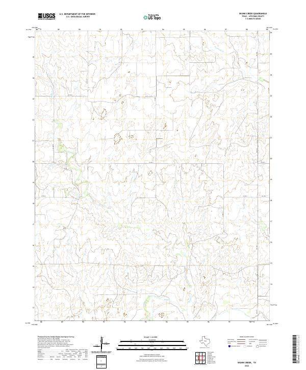
2022 Map of Skunk Creek
USGS Topo · Published 2022About this map
Wolf Cr and its tributaries define this corner of Lipscomb County, where the High Plains topography is deeply incised by a drainage network that includes Skunk Creek, Mammoth Cr, and Cat Cr. The map reveals a landscape dominated by large-scale agricultural and ranching patterns, evidenced by the grid-like progression of county roads such as Co RD N and Co RD 21. This 2022 survey captures the modern rural infrastructure of the Texas Panhandle, where state-maintained routes like FM 1454 intersect with local gravel paths to connect remote ranchlands. The absence of named settlements highlights the area's sparsely populated character, focusing instead on the hydrographic features and the essential transportation arteries that sustain the region's cattle and wheat economies.
Find a feature on this map
14 named features on this map. Tap any name to fly to it.
Don’t see what you’re looking for? This feature index may not catch every label — zoom into the map to look around manually.
Map Details
Editions of this 2022 Skunk Creek Map
This is the sole edition of this map. No revisions or reprints were ever made.
Other maps of this area

1954 · Perryton
USGS Topo · 1:250,000

1958 · Perryton
USGS Topo · 1:250,000

1972 · Follett SE
USGS Topo · 1:24,000

1972 · Dugout Creek
USGS Topo · 1:24,000

1972 · Skunk Creek
USGS Topo · 1:24,000
1972 · Magoun
USGS Topo · 1:24,000

1972 · Follett
USGS Topo · 1:24,000
1972 · Higgins North
USGS Topo · 1:24,000

1972 · Willow Creek
USGS Topo · 1:24,000

1972 · Lipscomb
USGS Topo · 1:24,000