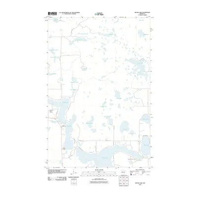
2010 Map of Skunk Lake
USGS Topo · Published 2010About this map
Potato Lake dominates the southern landscape of this Hubbard County region, serving as a primary focal point for the recreational and residential developments that define the area. To the west, the Sky Manor Aero Estates reflects a specific mid-century aviation-integrated residential pattern, situated near where Hay Creek winds toward the larger lake system. The map reveals an intricate network of water bodies, from the sprawling Many Arm Lake to the secluded Skunk Lake, illustrating a landscape shaped by glacial topography. This concentration of lakes has fostered a robust camping and leisure economy, evidenced by the established Breeze Campgrounds, Vagabond Village Campground, and the Eagles View Golf Course. Small service roads like Coon Lake Forest Rd and Hummingbird Dr provide access to seasonal homes and forest tracts between these numerous basins.
Find a feature on this map
44 named features on this map. Tap any name to fly to it.
Don’t see what you’re looking for? This feature index may not catch every label — zoom into the map to look around manually.
Map Details
Editions of this 2010 Skunk Lake Map
This is the sole edition of this map. No revisions or reprints were ever made.
Other maps of this area

1953 · Brainerd
USGS Topo · 1:250,000

1954 · Bemidji
USGS Topo · 1:250,000

1957 · Brainerd
USGS Topo · 1:250,000

1957 · Bemidji
USGS Topo · 1:250,000

1958 · Bemidji
USGS Topo · 1:250,000

1958 · Brainerd
USGS Topo · 1:250,000

1965 · Brainerd
USGS Topo · 1:250,000

1969 · Park Rapids
USGS Topo · 1:24,000
1969 · Park Rapids NW
USGS Topo · 1:24,000

1970 · Dorset
USGS Topo · 1:24,000