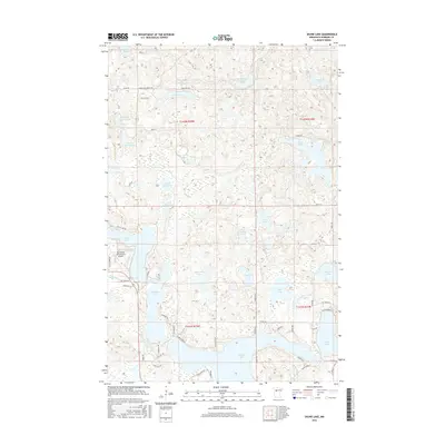
2016 Map of Skunk Lake
USGS Topo · Published 2016About this map
Potato Lake and the sprawling wetland networks of Hubbard County define this landscape of glacial kettle lakes and winding creeks. The map documents a transition from the dense cluster of water bodies like Many Arm Lake and Eagle Lake to the residential development surrounding the Sky Manor Aero Estates Airport. This 2016 survey illustrates the extensive local road network that has developed around these water features, with family-named routes and recreational tracks such as Coon Lake Forest Rd and Gunflint Dr providing access to isolated shorelines. The topography reveals a complex drainage pattern where Hay Creek moves through a series of marshes, connecting smaller basins like Lower Mud Lake and Upper Mud Lake before reaching the larger reservoirs in the southern half of the quadrangle.
Find a feature on this map
65 named features on this map. Tap any name to fly to it.
Don’t see what you’re looking for? This feature index may not catch every label — zoom into the map to look around manually.
Map Details
Editions of this 2016 Skunk Lake Map
This is the sole edition of this map. No revisions or reprints were ever made.
Other maps of this area

1953 · Brainerd
USGS Topo · 1:250,000

1954 · Bemidji
USGS Topo · 1:250,000

1957 · Brainerd
USGS Topo · 1:250,000

1957 · Bemidji
USGS Topo · 1:250,000

1958 · Bemidji
USGS Topo · 1:250,000

1958 · Brainerd
USGS Topo · 1:250,000

1965 · Brainerd
USGS Topo · 1:250,000

1969 · Park Rapids
USGS Topo · 1:24,000
1969 · Park Rapids NW
USGS Topo · 1:24,000

1970 · Dorset
USGS Topo · 1:24,000