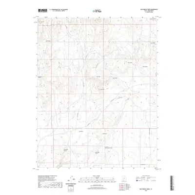
2020 Map of Skutumpah Creek
USGS Topo · Published 2020About this map
Skutumpah Canyon and the surrounding high desert terrain define this corner of Kane County. The landscape is characterized by a complex network of ephemeral drainages and named washes, including Adams Wash and Red Wash, which feed into larger systems like Skutumpah Cr. Vital water sources for local land use are marked at Old Corral Spring, First Point Spring, and Cottonwood Spring, highlighting the critical points for livestock or travel in an arid environment. Access across the plateau is facilitated by several back-country routes such as Skutumpah Rd and Table Mountain Rd, which navigate between prominent elevations like Table Mtn and Carly Knoll. The inclusion of features such as the Red Breaks and Skutumpah Terrace provides clear evidence of the geological stratification and erosional patterns of the region.
Find a feature on this map
31 named features on this map. Tap any name to fly to it.
Don’t see what you’re looking for? This feature index may not catch every label — zoom into the map to look around manually.
Map Details
Editions of this 2020 Skutumpah Creek Map
This is the sole edition of this map. No revisions or reprints were ever made.
Other maps of this area

1886 · Kanab
USGS Topo · 1:250,000

1953 · Cedar City
USGS Topo · 1:250,000

1954 · Buckskin Gulch NW
USGS Topo · 1:24,000

1954 · Johnson NE
USGS Topo · 1:24,000

1954 · Buckskin Gulch
USGS Topo · 1:62,500

1954 · Johnson
USGS Topo · 1:62,500

1958 · Cedar City
USGS Topo · 1:250,000

1962 · Cedar City
USGS Topo · 1:250,000

1966 · Alton
USGS Topo · 1:24,000

1966 · Bald Knoll
USGS Topo · 1:24,000