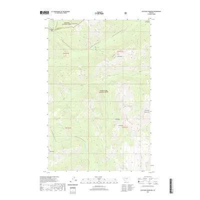
2020 Map of Slategoat Mountain
USGS Topo · Published 2020About this map
The Chinese Wall stands as a massive geologic landmark along the southern portion of this high-altitude landscape, where the Flathead National Forest meets the Lewis & Clark National Forest. This remote wilderness area is defined by the Lewis and Clark Range, featuring prominent elevations such as Slategoat Mtn and Redhead Peak. The Continental Divide National Scenic Trail winds through the terrain, crossing near Spotted Bear Pass and following the high ridges that separate western and eastern watersheds. Numerous drainages, including the Spotted Bear River, Moose Cr, and the headwaters of the W Fork Sun River, carve through the steep topography. The lack of roads or permanent settlements emphasizes the region's character as a preserved backcountry corridor, centered on the physical spine of the Continental Divide National Scenic Trail.
Find a feature on this map
24 named features on this map. Tap any name to fly to it.
Don’t see what you’re looking for? This feature index may not catch every label — zoom into the map to look around manually.
Map Details
Editions of this 2020 Slategoat Mountain Map
This is the sole edition of this map. No revisions or reprints were ever made.
Other maps of this area

1903 · Saypo
USGS Topo · 1:125,000

1936 · Silvertip
USGS Topo · 1:96,000

1942 · Silvertip
USGS Topo · 1:125,000

1955 · Choteau
USGS Topo · 1:250,000

1957 · Choteau
USGS Topo · 1:250,000

1958 · Choteau
USGS Topo · 1:250,000

1958 · Glenn Creek
USGS Topo · 1:24,000

1958 · Pretty Prairie
USGS Topo · 1:24,000

1958 · Gates Park
USGS Topo · 1:24,000

1962 · Choteau
USGS Topo · 1:250,000