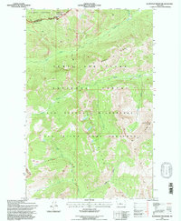
1995 Map of Slategoat Mountain
USGS Topo · Published 1997About this map
Continental Divide geography defines this high-elevation survey at the boundary of Flathead Co and Lewis And Clark Co. The landscape is dominated by protected wildlands, including the sprawling Bob Marshall Wilderness and the Sun River Game Preserve. Notable topographic landmarks include the massive limestone escarpment known as the Chinese Wall and the summit of Slategoat Mountain. This 1990s revision traces the vital waterways of the West Fork Sun River and South Fork Sun River, alongside the remote route of the Continental Divide National Scenic Trail. The map serves as a primary record of the intersection between the Flathead National Forest and Lewis and Clark National Forest during the late twentieth century.
Find a feature on this map
24 named features on this map. Tap any name to fly to it.
Don’t see what you’re looking for? This feature index may not catch every label — zoom into the map to look around manually.
Map Details
Editions of this 1995 Slategoat Mountain Map
This is the sole edition of this map. No revisions or reprints were ever made.
Other maps of this area

1903 · Saypo
USGS Topo · 1:125,000

1936 · Silvertip
USGS Topo · 1:96,000

1942 · Silvertip
USGS Topo · 1:125,000

1955 · Choteau
USGS Topo · 1:250,000

1957 · Choteau
USGS Topo · 1:250,000

1958 · Choteau
USGS Topo · 1:250,000

1958 · Glenn Creek
USGS Topo · 1:24,000

1958 · Pretty Prairie
USGS Topo · 1:24,000

1958 · Gates Park
USGS Topo · 1:24,000

1962 · Choteau
USGS Topo · 1:250,000