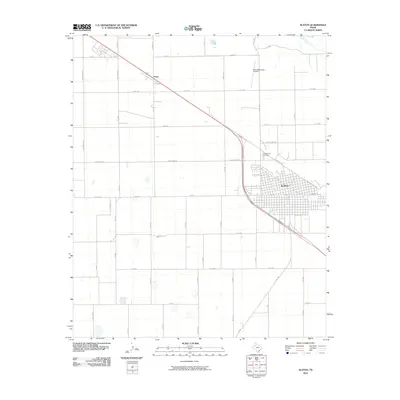
2010 Map of Slaton
USGS Topo · Published 2010About this map
Slaton anchors this Llano Estacado landscape, where a dense urban street grid meets the expansive agricultural section lines of Lubbock County. The town's layout reflects its railroad roots, with Railroad Ave paralleling the transit corridor that cuts diagonally across the high plains. Northwest of the main settlement lies Posey, a smaller point along the same rail line, surrounded by a network of rural roads named for the botanic diversity of the region, such as Verbena Ave and Nectarine Ave. Local infrastructure is well-defined by the Slaton Municipal Airport and the centrally located Englewood Cemetery, serving as key landmarks for genealogists and researchers. The map captures the geometric precision of the Texas Panhandle's rural development, where numbered roads like Co Rd 3000 and E C R 7900 define the limits of cotton and grain fields.
Find a feature on this map
50 named features on this map. Tap any name to fly to it.
Don’t see what you’re looking for? This feature index may not catch every label — zoom into the map to look around manually.
Map Details
Editions of this 2010 Slaton Map
This is the sole edition of this map. No revisions or reprints were ever made.
Other maps of this area

1954 · Lubbock
USGS Topo · 1:250,000

1957 · Lubbock East
USGS Topo · 1:24,000

1957 · New Home
USGS Topo · 1:62,500

1957 · Lubbock
USGS Topo · 1:62,500

1965 · Acuff
USGS Topo · 1:24,000

1965 · Slaton
USGS Topo · 1:24,000

1965 · Buffalo Springs Lake
USGS Topo · 1:24,000

1965 · Southland
USGS Topo · 1:24,000

1965 · Wilson
USGS Topo · 1:24,000

1965 · Slaton NE
USGS Topo · 1:24,000