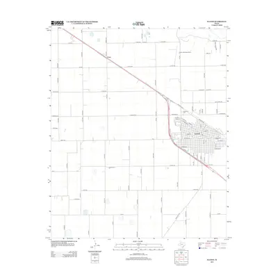
2012 Map of Slaton
USGS Topo · Published 2012About this map
The agricultural plains of Lubbock County take center stage in this 2012 survey, defined by the grid-like expansion of rural roads and the urban core of Slaton. Bisected by the diagonal path of Highway 84, the landscape transitions from the dense street blocks of the town to the outlying community of Posey. The town’s outskirts are marked by several significant local landmarks, including Englewood Cem and the Slaton Municipal Airport, which serve as anchors for the surrounding farmland. A complex network of farm-to-market roads, such as FM-835 and FM-1585, facilitates movement across the High Plains, connecting these settlements to the broader regional trade routes. This map provides a detailed view of the modern infrastructure and land use patterns that characterize this portion of the Texas Panhandle, from the organized residential streets of Slaton to the expansive sections of rural acreage defined by routes like E Woodrow Rd.
Find a feature on this map
78 named features on this map. Tap any name to fly to it.
Don’t see what you’re looking for? This feature index may not catch every label — zoom into the map to look around manually.
Map Details
Editions of this 2012 Slaton Map
This is the sole edition of this map. No revisions or reprints were ever made.
Other maps of this area

1954 · Lubbock
USGS Topo · 1:250,000

1957 · Lubbock East
USGS Topo · 1:24,000

1957 · New Home
USGS Topo · 1:62,500

1957 · Lubbock
USGS Topo · 1:62,500

1965 · Acuff
USGS Topo · 1:24,000

1965 · Slaton
USGS Topo · 1:24,000

1965 · Buffalo Springs Lake
USGS Topo · 1:24,000

1965 · Southland
USGS Topo · 1:24,000

1965 · Wilson
USGS Topo · 1:24,000

1965 · Slaton NE
USGS Topo · 1:24,000