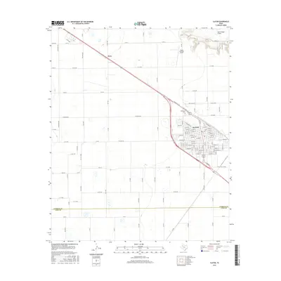
2016 Map of Slaton
USGS Topo · Published 2016About this map
Slaton serves as the primary hub of this High Plains landscape, situated just north of the Lubbock Co and Lynn Co line. The town's layout is deeply influenced by the transit corridors of Bus 84 and Railroad Ave, which reflect the region's historic reliance on rail and highway connectivity for agricultural transport. To the northwest, the small settlement of Posey sits along the same highway corridor, surrounded by a dense grid of county roads such as 114th St and Posey Rd that define the local section-line farming pattern. The topography is relatively level, broken notably in the northeast by the descending contours of Yellow House Canyon. Landmarks like the Slaton Municipal Airport and Englewood Cem provide specific points of interest for genealogists and local historians tracking the development of this South Plains community.
Find a feature on this map
124 named features on this map. Tap any name to fly to it.
Don’t see what you’re looking for? This feature index may not catch every label — zoom into the map to look around manually.
Map Details
Editions of this 2016 Slaton Map
This is the sole edition of this map. No revisions or reprints were ever made.
Other maps of this area

1954 · Lubbock
USGS Topo · 1:250,000

1957 · Lubbock East
USGS Topo · 1:24,000

1957 · New Home
USGS Topo · 1:62,500

1957 · Lubbock
USGS Topo · 1:62,500

1965 · Acuff
USGS Topo · 1:24,000

1965 · Slaton
USGS Topo · 1:24,000

1965 · Buffalo Springs Lake
USGS Topo · 1:24,000

1965 · Southland
USGS Topo · 1:24,000

1965 · Wilson
USGS Topo · 1:24,000

1965 · Slaton NE
USGS Topo · 1:24,000