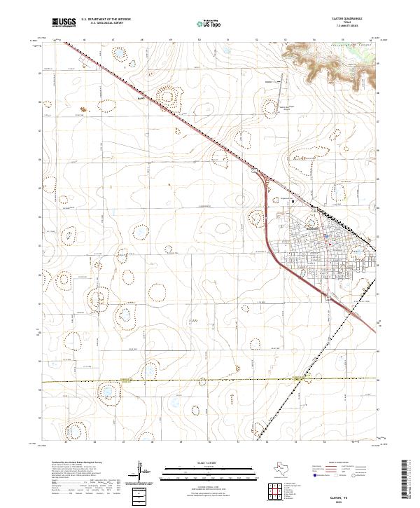
2022 Map of Slaton
USGS Topo · Published 2022About this map
Slaton anchors this High Plains landscape, revealing a town defined by its linear grid and connection to the rail corridor. The map highlights the transition from the organized street network of the town center to the vast agricultural surroundings of the Panhandle. To the northwest, the settlement of Posey sits along the highway, while the dramatic topography of Yellow House Canyon cuts across the northeastern corner of the quadrangle, offering a sharp contrast to the surrounding level terrain.
Find a feature on this map
123 named features on this map. Tap any name to fly to it.
Don’t see what you’re looking for? This feature index may not catch every label — zoom into the map to look around manually.
Map Details
Editions of this 2022 Slaton Map
This is the sole edition of this map. No revisions or reprints were ever made.
Other maps of this area

1954 · Lubbock
USGS Topo · 1:250,000

1957 · Lubbock East
USGS Topo · 1:24,000

1957 · New Home
USGS Topo · 1:62,500

1957 · Lubbock
USGS Topo · 1:62,500

1965 · Acuff
USGS Topo · 1:24,000

1965 · Slaton
USGS Topo · 1:24,000

1965 · Buffalo Springs Lake
USGS Topo · 1:24,000

1965 · Southland
USGS Topo · 1:24,000

1965 · Wilson
USGS Topo · 1:24,000

1965 · Slaton NE
USGS Topo · 1:24,000