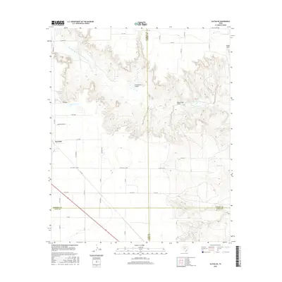
2016 Map of Slaton NE
USGS Topo · Published 2016About this map
Yellow House Canyon and the N Fork Double Mountain Fork Brazos River cut a deep, winding path through the Llano Estacado on this West Texas landscape. The city of Slaton sits on the western edge of the quadrangle, where the flat agricultural plains abruptly meet the break in the caprock. This transition from high plains to canyon country is defined by numerous drainage features including Long Hollow Canyon, Turkey Draw, and Spring Cr. The map captures the meeting point of four counties — Lubbock, Crosby, Lynn, and Garza — highlighting how these political boundaries intersect with the natural topography of the Brazos River's upper reaches. Transportation is dominated by a grid of county roads and routes like Ranch Rd 2150, which navigate the increasingly complex terrain as it descends into the canyon systems.
Find a feature on this map
41 named features on this map. Tap any name to fly to it.
Don’t see what you’re looking for? This feature index may not catch every label — zoom into the map to look around manually.
Map Details
Editions of this 2016 Slaton NE Map
This is the sole edition of this map. No revisions or reprints were ever made.
Other maps of this area

1954 · Lubbock
USGS Topo · 1:250,000

1965 · Acuff
USGS Topo · 1:24,000

1965 · Slaton
USGS Topo · 1:24,000

1965 · Buffalo Springs Lake
USGS Topo · 1:24,000

1965 · Southland
USGS Topo · 1:24,000

1965 · Wilson
USGS Topo · 1:24,000

1965 · Slaton NE
USGS Topo · 1:24,000

1966 · Cap Rock
USGS Topo · 1:24,000

1967 · Savage
USGS Topo · 1:24,000

1968 · South Dokegood Creek
USGS Topo · 1:24,000